ALPHETON HALL BARNS - Historic Wedding Venue
HOME - THE BARNS - AVAILABILITY - BOOKING & PRICES - HISTORY GALLERY - NEWS - CHURCH WEDDINGS - CIVIL CEREMONIES CONTACT US - EULOGIES - LINKS - SITE INDEX - BLOG
The Setting
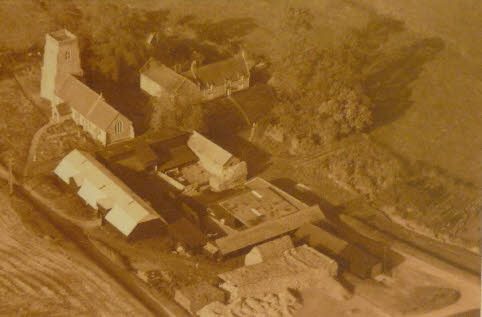
The earliest aerial photograph we can find dates back to the early 1960's and clearly shows the Straw Stacks in what is now the Stackyard garden, and the new roof to the South Barn. Little else has changed save for the planting of thousands of trees and hedging plants. Analysis of the earliest maps show that there has been no change since 1805 if not earlier.
The close proximity of the church to the venue can be clearly seen, together with the scale and extent of the South barn and its privacy.
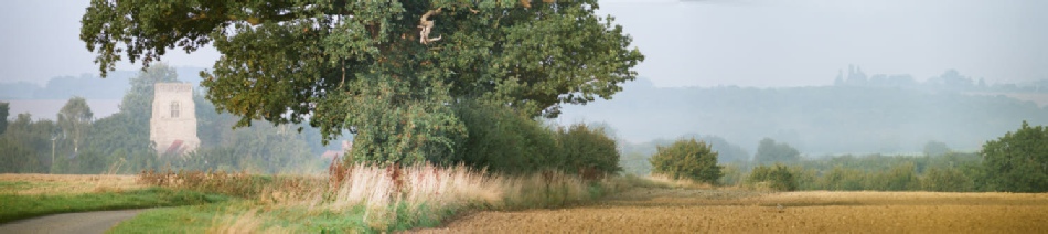
The drive down to the venue is a treat, you pass down the "dead end" single track road through organic farmland with only the occasional view of the parish church and the roof of the barn till the last moment before you arrive. The area is a hive of wildlife from the domestic fowl and animals to the haunting cry of the buzzards circling overhead up amongst the clouds.